I’m happy to announce that I have accepted a tenure-track offer from Northeastern University as an assistant professor of urban informatics in the School of Public Policy and Urban Affairs, with a faculty affiliation in Northeastern’s Network Science Institute. I will be starting in the Fall and moving to Boston later this summer!
Tag: networks
Network-Based Spatial Clustering
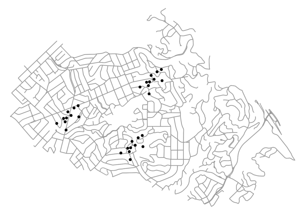
Jobs, establishments, and other amenities tend to agglomerate and cluster in cities. To identify these agglomerations and explore their causes and effects, we often use spatial clustering algorithms. However, urban space cannot simply be traversed as-the-crow-flies: human mobility is network-constrained. To properly model agglomeration along a city’s street network, we must use network-based spatial clustering.
The code for this example can be found in this GitHub repo. We use OSMnx to download and assemble the street network for a small city. We also have a dataframe of points representing the locations of (fake) restaurants in this city. Our restaurants cluster into distinct districts, as many establishments and industries tend to do:
OSMnx Features Round-Up
OSMnx is a Python package for quickly and easily downloading, modeling, analyzing, and visualizing street networks and other spatial data from OpenStreetMap. Here’s a quick round-up of recent updates to OSMnx. I’ll try to keep this up to date as a single reference source. A lot of new features have appeared in the past few months, and people have been asking about what’s new and what’s possible. You can:
- Download and model street networks or other networked infrastructure anywhere in the world with a single line of code
- Download any other spatial geometries, place boundaries, building footprints, or points of interest as a GeoDataFrame
- Download by city name, polygon, bounding box, or point/address + network distance
- Download drivable, walkable, bikeable, or all street networks
- Download node elevations and calculate edge grades (inclines)
- Impute missing speeds and calculate graph edge travel times
- Simplify and correct the network’s topology to clean-up nodes and consolidate intersections
- Fast map-matching of points, routes, or trajectories to nearest graph edges or nodes
- Save networks to disk as shapefiles, geopackages, and GraphML
- Save/load street network to/from a local .osm xml file
- Conduct topological and spatial analyses to automatically calculate dozens of indicators
- Calculate and visualize street bearings and orientations
- Calculate and visualize shortest-path routes that minimize distance, travel time, elevation, etc
- Visualize street networks as a static map or interactive leaflet web map
- Visualize travel distance and travel time with isoline and isochrone maps
- Plot figure-ground diagrams of street networks and building footprints
Street Network Orientation
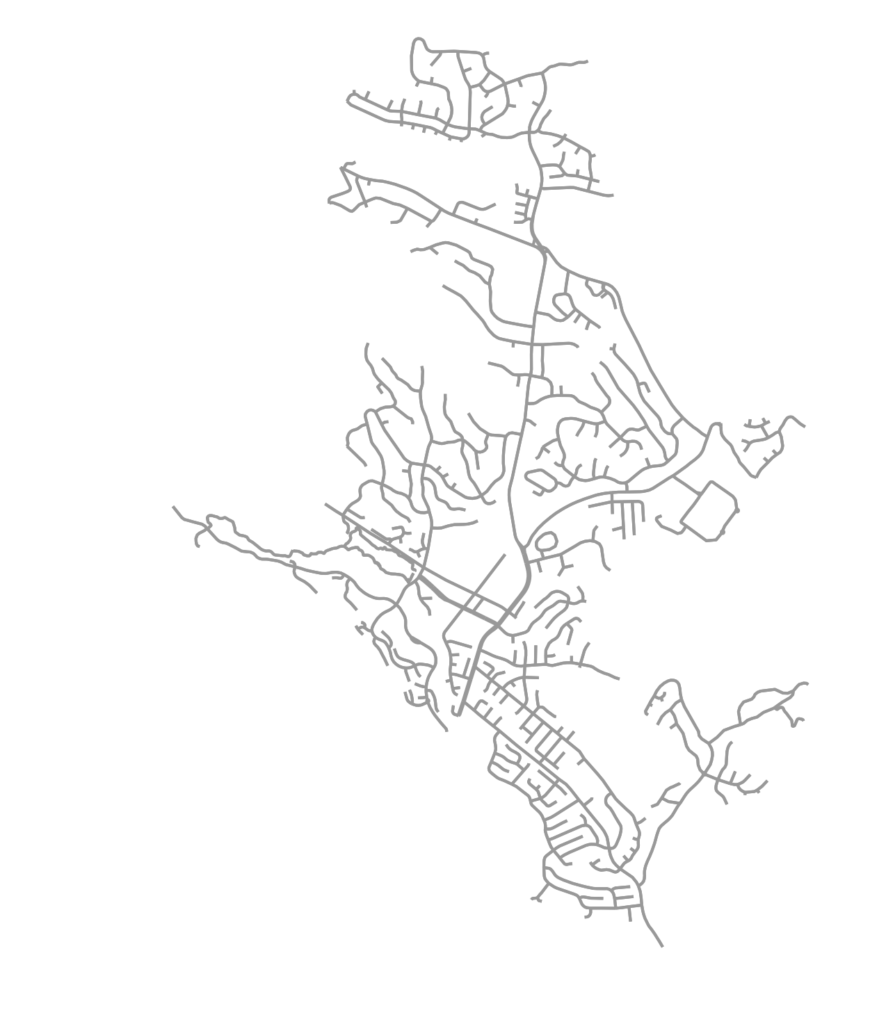
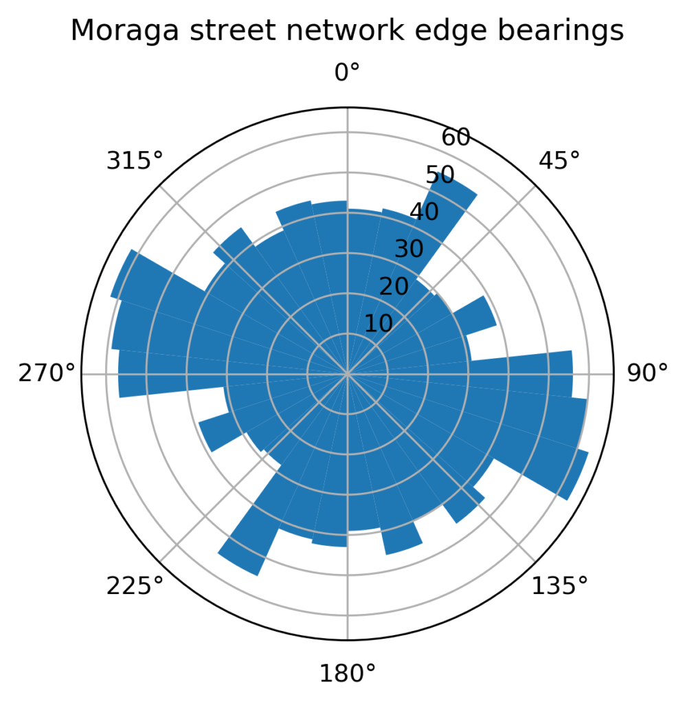
OSMnx is a Python package for easily downloading and analyzing street networks anywhere in the world. Among other analyses, we can use it to explore street network orientation. That is, what are the bearings and spatial orientations of the streets in the network? All of the code for this example is in this GitHub notebook. First we use OSMnx to download the street network of Moraga, California, a small town in the hills just east of Berkeley:
OSMnx automatically calculates all of the streets’ bearings. Specifically it calculates the compass bearing from each directed edge’s origin node u to its destination node v. Now we can visualize these bearings, binned together as a histogram to get a sense of the relative frequency of the streets’ spatial orientations. Or better yet, we can project that histogram as a polar plot to match the compass bearings:
Urban Street Network Centrality
Check out the journal article about OSMnx.
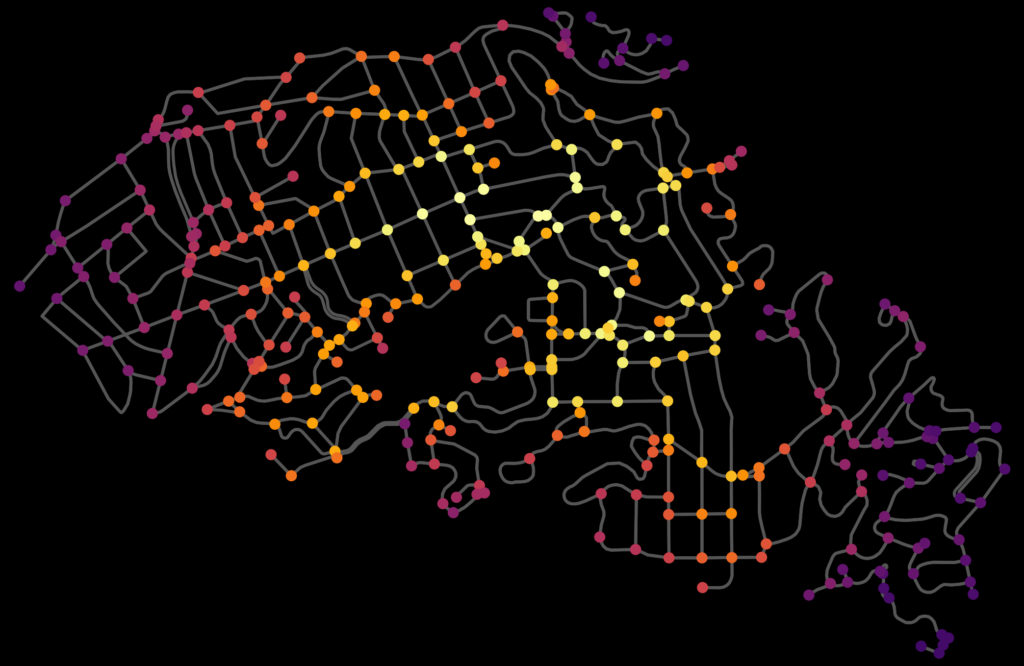
We can measure and visualize how “important” a node or an edge is in a network by calculating its centrality. Lots of flavors of centrality exist in network science, including closeness, betweenness, degree, eigenvector, and PageRank. Closeness centrality measures the average shortest path between each node in the network and every other node: more central nodes are closer to all other nodes. We can calculate this easily with OSMnx, as seen in this GitHub demo. For example, here is the node closeness centrality for Piedmont, California:
New Article: OSMnx in CEUS
My article “OSMnx: New methods for acquiring, constructing, analyzing, and visualizing complex street networks” was published in the journal Computers, Environment and Urban Systems earlier this month. OSMnx is a Python package that lets you download a street network anywhere in the world at any scale with a single line of code, then analyze or visualize it with one more line of code.
Isochrone Maps with OSMnx + Python
Check out the journal article about OSMnx.
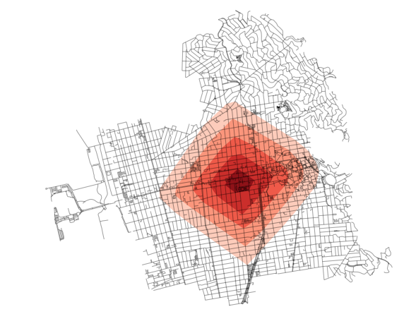
How far can you travel on foot in 15 minutes? Urban planners use isochrone maps to show spatial horizons (i.e., isolines) that are equal in time. Isochrones depict areas according to how long it takes to arrive there from some point. These visualizations are particularly useful in transportation planning as they reveal what places are accessible within a set of time horizons.
We can create isochrone maps for anywhere in the world automatically with Python and its OSMnx package:
OSMnx and Street Network Elevation Data
Check out the journal article about OSMnx.
OSMnx can now download street network elevation data for anywhere in the world. In one line of code it downloads the elevation in meters of each network node, and in one more line of code it can calculate every street (i.e., edge) grade. Here is the complete street network of San Francisco, California, with nodes colored according to their elevation:
Check out the journal article about OSMnx. This is a summary of some of my recent research on making OpenStreetMap data analysis easy for urban planners. It was also published on the ACSP blog.
OpenStreetMap – a collaborative worldwide mapping project inspired by Wikipedia – has emerged in recent years as a major player both for mapping and acquiring urban spatial data. Though coverage varies somewhat worldwide, its data are of high quality and compare favorably to CIA World Factbook estimates and US Census TIGER/Line data. OpenStreetMap imported the TIGER/Line roads in 2007 and since then its community has made numerous corrections and improvements. In fact, many of these additions go beyond TIGER/Line’s scope, including for example passageways between buildings, footpaths through parks, bike routes, and detailed feature attributes such as finer-grained street classifiers, speed limits, etc.
This presents a fantastic data source to help answer urban planning questions, but OpenStreetMap’s data has been somewhat difficult to work with due to its Byzantine query language and coarse-grained bulk extracts provided by third parties. As part of my dissertation, I developed a tool called OSMnx that allows researchers to download street networks and building footprints for any city name, address, or polygon in the world, then analyze and visualize them. OSMnx democratizes these data and methods to help technical and non-technical planners and researchers use OpenStreetMap data to study urban form, circulation networks, accessibility, and resilience.
Urban Form Figure-Ground Diagrams
Check out the journal article about OSMnx.
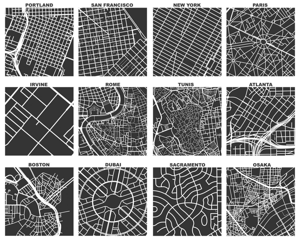
I previously demonstrated how to create figure-ground square-mile visualizations of urban street networks with OSMnx to consistently compare city patterns, design paradigms, and connectivity. OSMnx downloads, analyzes, and visualizes street networks from OpenStreetMap but it can also get building footprints. If we mash-up these building footprints with the street networks, we get a fascinating comparative window into urban form: