Categories
Planning

Rethinking the One-Way Street

I recently published an article in Transfers Magazine with Billy Riggs questioning some of the received wisdom about one-way streets and efficiency. This builds on our recent research published in JPER modeling vehicle distance traveled before and after hypothetical one-way to two-way street conversions.

Categories
Planning

City Street Orientations around the World

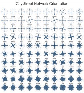
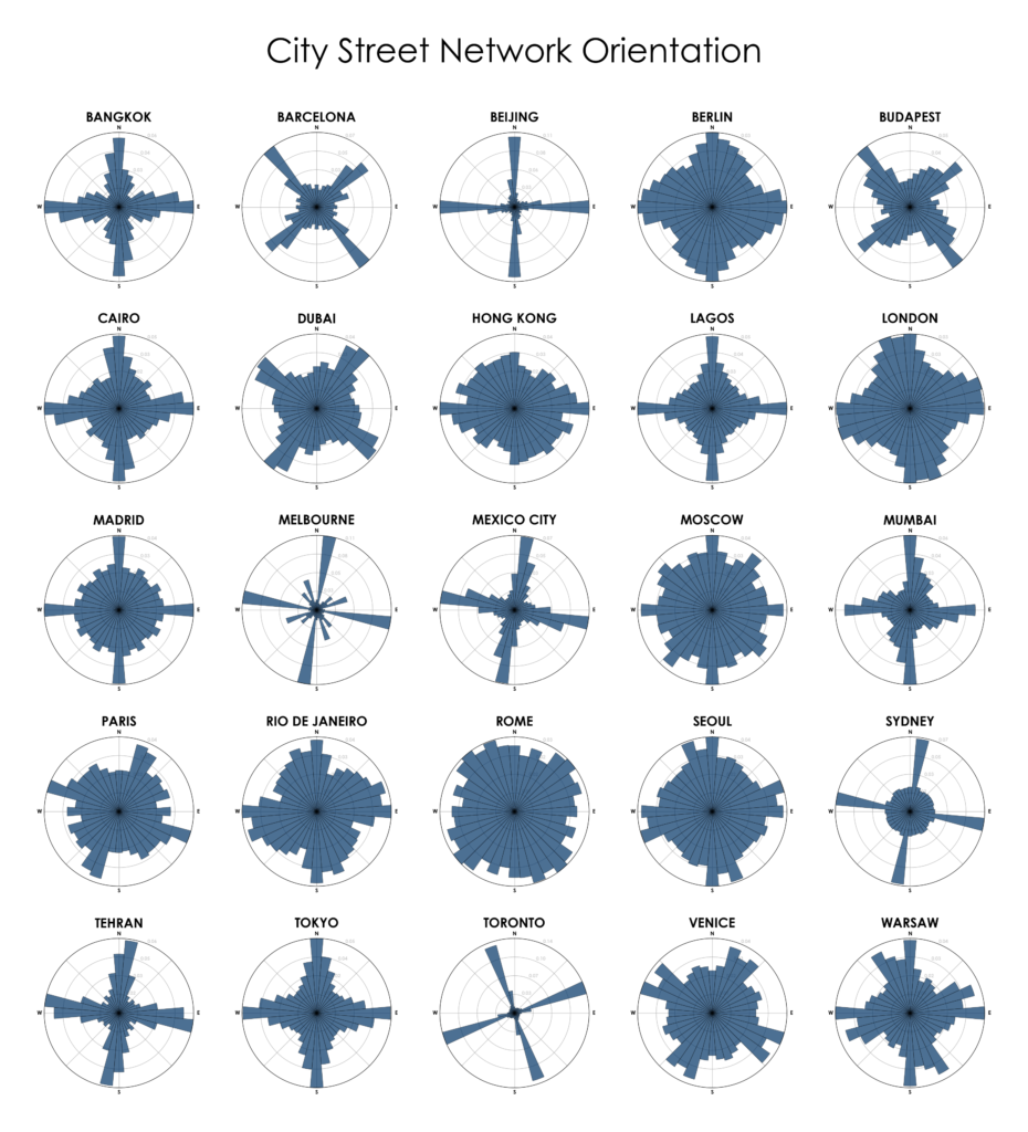
City street network grid orientations, order, disorder, entropy, rose plot, polar histogram made with Python, OSMnx, OpenStreetMap, matplotlib.This post is adapted from this research paper that you can read/cite for more info. It analyzes and visualizes 100 cities around the world.

By popular request, this is a quick follow-up to this post comparing the orientation of streets in 25 US cities using Python and OSMnx. Here are 25 more cities around the world:

City street network grid orientations, rose plot, polar histogram made with Python, OSMnx, OpenStreetMap, matplotlib. Bangkok, Barcelona, Beijing, Budapest, Cairo, Delhi, Dubai, Glasgow, Hong Kong, Lagos, London, Madrid, Melbourne, Mexico City, Moscow, Mumbai, Munich, Paris, Rio de Janeiro, Rome, Seoul, Sydney, Tehran, Toronto, Warsaw, Tokyo, Berlin, Venice

Categories
Data

OSMnx and Street Network Elevation Data

Check out the journal article about OSMnx.

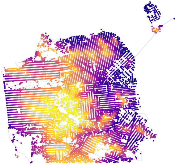
OSMnx can now download street network elevation data for anywhere in the world. In one line of code it downloads the elevation in meters of each network node, and in one more line of code it can calculate every street (i.e., edge) grade. Here is the complete street network of San Francisco, California, with nodes colored according to their elevation:

OSMnx street network elevation data for San Francisco, California to calculate street grade and steepness

Categories
Planning

OSMnx: Python for Street Networks

OSMnx: New York City urban street network visualized and analyzed with Python and OpenStreetMap dataIf you use OSMnx in your work, please cite the journal article.
OSMnx is a Python package to retrieve, model, analyze, and visualize street networks from OpenStreetMap. Users can download and model walkable, drivable, or bikeable urban networks with a single line of Python code, and then easily analyze and visualize them. You can just as easily download and work with amenities/points of interest, building footprints, elevation data, street bearings/orientations, and network routing. If you use OSMnx in your work, please download/cite the paper here.

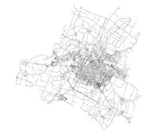
In a single line of code, OSMnx lets you download, model, and visualize the street network for, say, Modena Italy:

import osmnx as ox
ox.plot_graph(ox.graph_from_place('Modena, Italy'))

OSMnx: Modena Italy networkx street network in Python from OpenStreetMap