Categories
Data

Urban Analytics: History, Trajectory and Critique

I have a new chapter titled “Urban Analytics: History, Trajectory and Critique,” co-authored with Mike Batty, Shan Jiang, and Lisa Schweitzer, now published in the Handbook of Spatial Analysis in the Social Sciences, edited by Serge Rey and Rachel Franklin.

From our abstract:

Urban analytics combines spatial analysis, statistics, computer science, and urban planning to understand and shape city futures. While it promises better policymaking insights, concerns exist around its epistemological scope and impacts on privacy, ethics, and social control. This chapter reflects on the history and trajectory of urban analytics as a scholarly and professional discipline. In particular, it considers the direction in which this field is going and whether it improves our collective and individual welfare. It first introduces early theories, models, and deductive methods from which the field originated before shifting toward induction. It then explores urban network analytics that enrich traditional representations of spatial interaction and structure. Next it discusses urban applications of spatiotemporal big data and machine learning. Finally, it argues that privacy and ethical concerns are too often ignored as ubiquitous monitoring and analytics can empower social repression. It concludes with a call for a more critical urban analytics that recognizes its epistemological limits, emphasizes human dignity, and learns from and supports marginalized communities.

For more, check out the chapter.
Categories
Data

GIS and Computational Notebooks

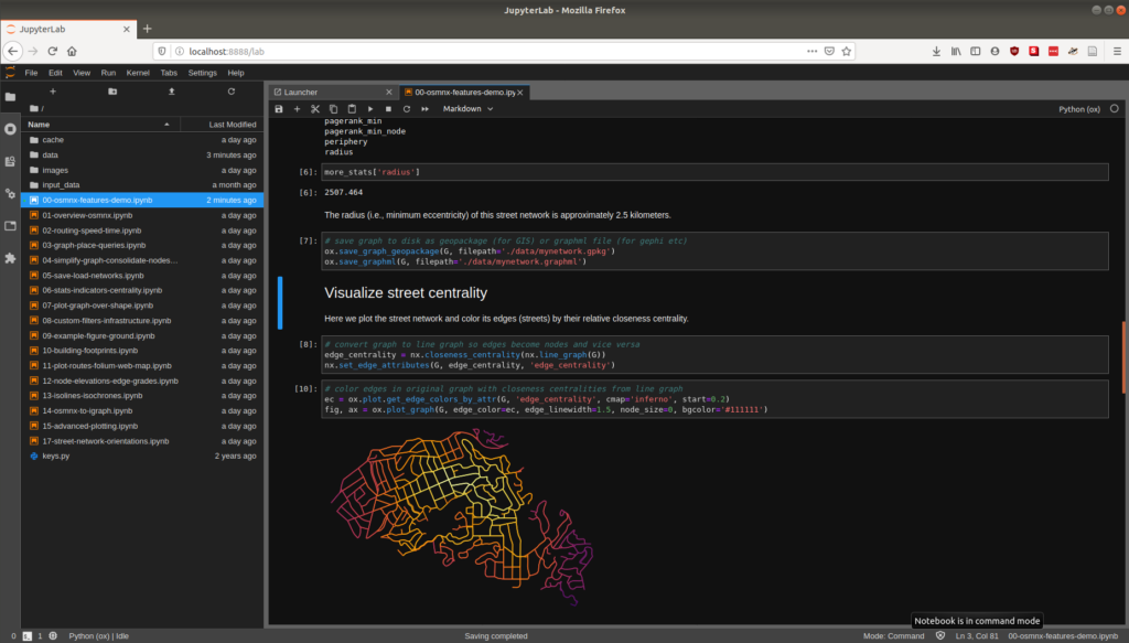
I have a new chapter “GIS and Computational Notebooks,” co-authored with Dani Arribas-Bel, out now in The Geographic Information Science & Technology Body of Knowledge. Want to make your spatial analyses more reproducible, portable, and well-documented? Our chapter is a short, gentle intro to using code and notebooks for modern GIS work.

Science and analytics both struggle with reproducibility, documentation, and portability. But GIS in both research and practice particularly suffers from these problems due to some of its unique characteristics. Our chapter discusses this challenge and its urgency for building better and more actionable knowledge from geospatial data. Then we introduce an emerging solution, the computational notebook, using Jupyter as our central example to illustrate what it does and how it works.

Jupyter notebook JupyterLab user interface

Categories
Data

Street Network Analysis in a Docker Container

Containerization is the way of the future present. I’ve heard feedback from some folks over the past few months who would like to play around with OSMnx for street network analysis, transport modeling, and urban design—but can’t because they can’t install Python and its data science stack on their computers. Furthermore, it would be nice to have a consistent reference environment to deploy on AWS or elsewhere in the cloud.

So, I’ve created a docker image containing OSMnx, Jupyter, and the rest of the Python geospatial data science stack, available on docker hub alongside additional usage instructions. If you’re starting from scratch, you can get started in four simple steps: