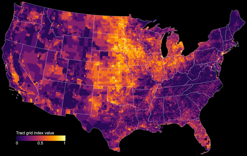
My article “Off the Grid… and Back Again? The Recent Evolution of American Street Network Planning and Design” has been published by the Journal of the American Planning Association and won the 2020 Stough-Johansson Springer Award for best paper. It identifies recent nationwide trends in American street network design, measuring how urban planners abandoned the grid and embraced sprawl over the 20th century, but since 2000 these trends have rebounded, shifting back toward historical design patterns. In this post I discuss these findings and visualizations across the US today as well as over time, then discuss my analysis methods.
Categories
Off the Grid… and Back Again?
- Post author By gboeing
- Post date 2020-11-01
- 7 Comments on Off the Grid… and Back Again?
- Tags academia, census tract, city, connectivity, data, data science, design, entropy, geospatial, gis, grid, land use, maps, modeling, neighborhood, networks, new urbanism, openstreetmap, orientation, osmnx, planning, python, science, spatial analysis, street-network, transportation, united states, urban, urban analytics, urban design, urban form, urban morphology, urban planning, visualization
