Isochrone Maps with OSMnx + Python
Check out the journal article about OSMnx.
How far can you travel on foot in 15 minutes? Urban planners use isochrone maps to show spatial horizons (i.e., isolines) that are equal in time. Isochrones depict areas according to how long it takes to arrive there from some point. These visualizations are particularly useful in transportation planning as they reveal what places are accessible within a set of time horizons.
We can create isochrone maps for anywhere in the world automatically with Python and its OSMnx package:
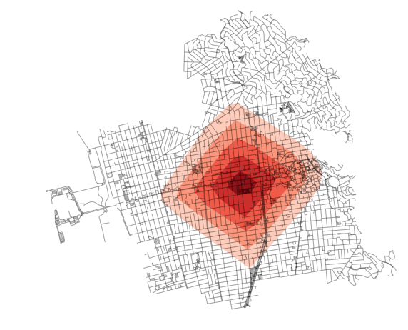
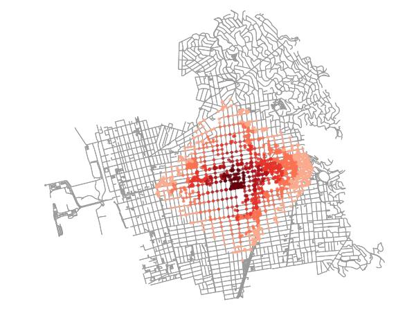
This travel time map shows how far we can walk in 5, 10, 15, 20, and 25 minutes from an origin point in downtown Berkeley, given an average walking speed of 4.5 km/hour (about 2.8 miles/hour). We can also visualize this by which points along the network we can reach within 5, 10, 15, 20, and 25 minutes:
You can create your own travel time maps for any city in the world by following this example in the OSMnx usage examples GitHub repo. OSMnx is a Python package for easily downloading, analyzing, and visualizing OpenStreetMap street networks anywhere in the world. Installation instructions are on GitHub.
If you’re interested in routing, travel times, and imputing road speeds, make sure to check out OSMnx’s new speed module.