US Street Network Models and Measures
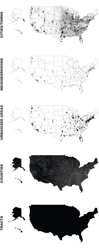
My new article, “Street Network Models and Measures for Every U.S. City, County, Urbanized Area, Census Tract, and Zillow-Defined Neighborhood” has been published in Urban Science. This paper reports results from a broader project that collected raw street network data from OpenStreetMap using the Python-based OSMnx software for every U.S. city and town, county, urbanized area, census tract, and Zillow-defined neighborhood boundary. It constructed nonplanar directed multigraphs for each and analyzed their structural and morphological characteristics.
The resulting public data repository contains over 110,000 processed, cleaned street network graphs (which in turn comprise over 55 million nodes and over 137 million edges) at various scales—comprehensively covering the entire U.S.—archived as reusable open-source GraphML files, node/edge lists, and ESRI shapefiles that can be immediately loaded and analyzed in standard tools such as ArcGIS, QGIS, NetworkX, graph-tool, igraph, or Gephi.
The repository also contains calculated indicators and measures of each network’s geometric and topological characteristics common in urban design, transportation planning, civil engineering, and network science. No other such comprehensive data set previously existed. These data offer researchers and practitioners a new ability to quickly and easily conduct graph-theoretic urban circulation network analysis anywhere in the U.S. using standard, free, open-source tools.
For more, check out the article or read more about OSMnx.