Check out the journal article about OSMnx.
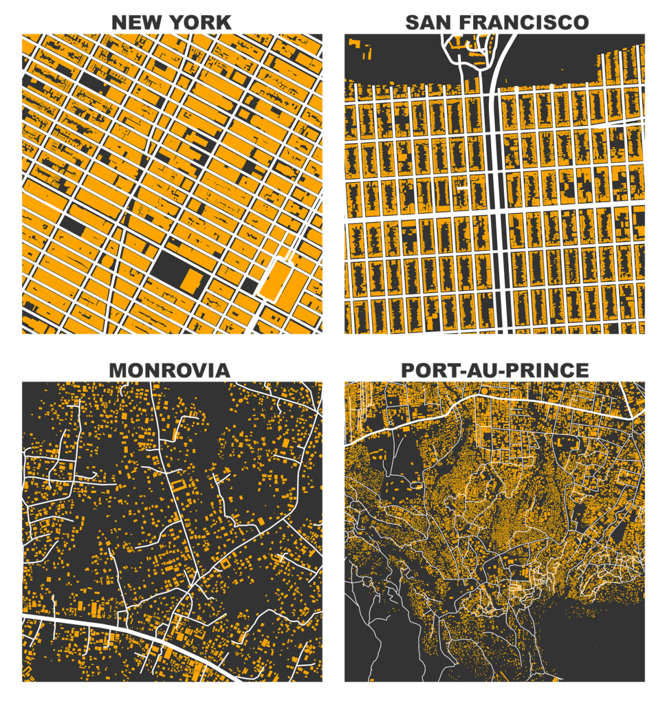
I previously demonstrated how to create figure-ground square-mile visualizations of urban street networks with OSMnx to consistently compare city patterns, design paradigms, and connectivity. OSMnx downloads, analyzes, and visualizes street networks from OpenStreetMap but it can also get building footprints. If we mash-up these building footprints with the street networks, we get a fascinating comparative window into urban form:
